GIS
Building a Spatial Data Catalog

A Sea of Geospatial Data
Spatial data has become indispensable to the business landscape. How could it not? Location is everything and everywhere. And the latest remote sensing technologies, IoT devices are getting better at capturing this location data. At face value, you’d think a sea of spatial data is all sunshine and rainbows. And it has the potential to be. But the reality is, a sea of geospatial data is too complicated for organizations to handle. What’s the quantification of this complication? Companies spend somewhere between $1.7M - $3.5M more than they should on spatial data management. This represents 10 to 35 Full-Time Employees (FTEs) doing in-house data management grunt work. That’s quite a waste of valuable resources.
In this article, we’re going to work through that complication by shedding light on how to efficiently manage this sea of geospatial data and turn it into a high-performance data library.
Let’s go!
Spatial Data Indexing
Let’s understand the process with the help of an analogy. Consider your spatial data files to be books. For most organizations, these spatial data files sit in existing object storage such as Amazon S3 or Azure Blob Storage. By extension of our analogy, these object storage spaces can be seen as empty warehouses where you have your pile of books. A humongous, unsorted pile of books.
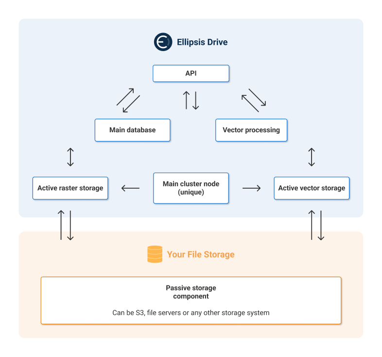
As a starting point, you need a librarian to sort and label this messy data if you ever hope to derive something meaningful out of it. Ellipsis Drive can act as that librarian who neatly and scalably organizes your books scattered across multiple storage buckets throughout your organization.

After deploying Ellipsis Drive in your own network and connecting your storage bucket(s) of choice, Ellipsis Drive indexes all of your spatial data files and automatically detects the following metadata of the files -
- Bounds
- Resolution
- Number of bands
- Band names
- Data types
- Compression
- Properties
- EPSG Data
A few additional metadata specifications need to be added manually such as layer name, timestamp, description and optionally a tag. Due to the indexing process, all your spatial data sets and assets are now discoverable and searchable based on the below parameters -
- Layer name
- Owner
- Tags
- Date Range
- Bounds
- Spatial extent
- Properties
- Style names
- Resolution
- Access Level
- Root
Congrats! You’ve labelled your unsorted pile of data opening up a plethora of use cases.
Now the backend of your spatial data catalog is in shape, but it’s still not ready to showcase your spatial intelligence to your end users. It needs to be made presentable and palatable for your stakeholders. How? By activating spatial data!
Spatial Data Activation
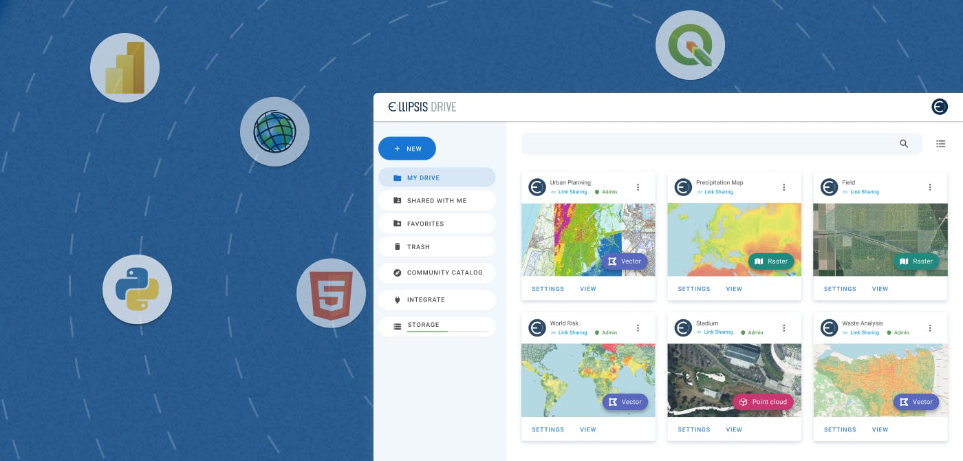
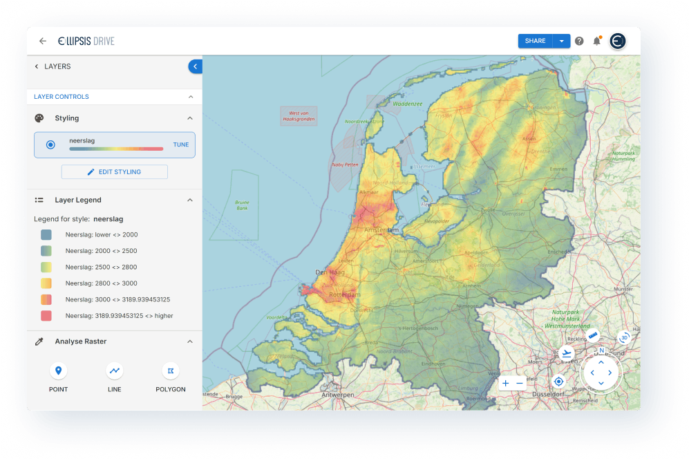
With a click of a button, Ellipsis Drive ‘activates’ your spatial content by turning your cold spatial files into high-performance and interoperable web services. Spatial data files under management are parsed, tiled, and reprojected into fully interoperable, web-based data layers. Ready for use by any audience you authorize. These interactive data layers can be visualized and managed directly via a web browser or integrated into your tools, applications and workflows of choice by utilizing a wide range of packages and plugins.

Now your library is open for internal and external stakeholders alike. Below is a summarization of the benefits of building out a spatial data catalog with Ellipsis Drive securely deployed within your own data infrastructure -
- Time Efficiency: 95%+ time saved on data management and transformation by automating spatial data ingestion, structuring and integration.
- Data Querying: 100X faster data querying through high performance spatial data use for data scientists, modelers, and developers compared to existing workflows.
- Seamless Access: Instant access to data to high performance spatial data to feed your modelling and apps.
- Interoperability: Instant spatial data transmission from one team or organization, to another.
- Scalability: 100% scalable spatial data ingestion and management pipeline for existing and new 2D/3D spatial data vendors
Conclusion
In conclusion, managing vast amounts of geospatial data doesn’t have to be complex or resource-intensive. With Ellipsis Drive, organizations can turn a chaotic, choppy sea of spatial data into a well-organized, high-performance data catalog—one that saves time, reduces costs, and accelerates decision-making. Ready to simplify and elevate your spatial data management?
Get in touch with our sales team to see how Ellipsis Drive can streamline your spatial data management strategy.
Liked what you read?

Subscribe to our monthly newsletter to receive the latest blogs, news and updates.
Take the Ellipsis Drive tour
in less than 2 minutes'
- A step-by-step guide on how to activate your geospatial data
- Become familiar with our user-friendly interface & design
- View your data integration options

Related Articles

Navigating the Cloud Spectrum: From Generalist to Specialized, and the Perfect Middle Ground
The modern cloud ecosystem spans a wide spectrum of offerings, from general-purpose infrastructure to highly specialized platforms built for domain-specific tasks. At one end, generalist clouds provi
5 min read

Unlocking the Potential of Data: Comparing Tabular and Non-Tabular Protocols
The world of data is a complex landscape and each year, the complexity of that landscape grows exponentially. A combination of new data capturing technology, data processing technology and demands fo
6 min read

Understanding the importance of GIS in Urban Planning
Cities are robust places filled with life, but before it becomes a cosmopolitan paradise, plenty of ever-evolving complexities are happening behind the scenes to bridge the gaps and create an area spa
3 min read