Expert's Opinion
Is it worth building an in–house Spatial Data Infrastructure?
Contents
Introduction
Humour us for a moment. Do you create a mailing server each time you want to send an email? Or do you design a file sharing server each time you want to share a document? Probably not ( and we hope not!). Why would you go through the hassle of reinventing the wheel, right? There are bigger fish to fry in your respective business endeavors.
Yet, when it comes to sharing and managing spatial data, we are inclined to forget these simple principles and take the Do-It-Yourself (DIY) approach. Why do we make these choices? How do the two situations differ? And what are the business repercussions of taking the DIY route? Let’s examine these questions further!
Building an in-house Spatial Data Infrastructure
To do business in the geospatial industry i.e. create, analyze, share or commercialize spatial content, you need a spatial data infrastructure (SDI). At present, most companies choose to build this SDI in-house.
Any conversation involving a home grown SDI is incomplete without mentioning Geoserver. Geoserver is one of the most widely used open source projects that is used by businesses to create the necessary IT infrastructure required to enable spatial data-led operations. You can think of it as a software toolbox that can be used to build and configure an SDI on a server to - for example - host spatial data and serve it out in an OGC compliant way (such as via WMS, WMTS, OGC Features API, OGC MapsAPI etc).
The Geoserver-powered in-house solution route has a valuable part to play in the industry, and has served organizations reasonably well thus far. But it has several glaring limitations. These limitations are similar to the ones highlighted at the beginning of this article. The cost ( in terms of time, money and energy) of launching and maintaining a Geoserver-powered infrastructure doesn’t make business sense. It is not the desired workflow by a long shot.
Characteristics of a great Spatial Data Infrastructure
The worst thing about the ‘in-house’ route is that the effort poured into building the infrastructure doesn’t translate seamlessly from one case to the other. It is a recurring debit of an organization’s time and money that slowly chips away at the bottom line. In the medium to long term it deters business, instead of enabling it.
Let’s take a look at what the basic characteristics of a great Spatial Data Infrastructure are -
Accessibility - The baseline infrastructure created for spatial data must have an intuitive user interface. Users of all technical levels should be able to login, create and transact with minimal effort.
Interoperability - It must make transacting via existing protocols easier rather than coming up with new protocols itself. A sender should be able to send without needing any new setup, or without worrying about which protocol to choose. Similarly, the receiver should also have the freedom to choose the mode of data transfer.
Scalability - The SDI should support various data formats, incorporate the latest geospatial technologies and translate across different business use cases without much intervention.
To know what makes up a future-proof spatial data infrastructure, click here.
Why did we engineer Ellipsis Drive?
A company can launch the latest technology in space, generate the most beautiful satellite imagery and design highly insightful risk models. Yet, without the right baseline infrastructure in place, it can turn out to be somewhat useless. Breaking out of this siloed setting is 1) cost intensive 2) time intensive.
This is the main reason why we engineered Ellipsis Drive – to bring down the cost of doing business within the geospatial industry.
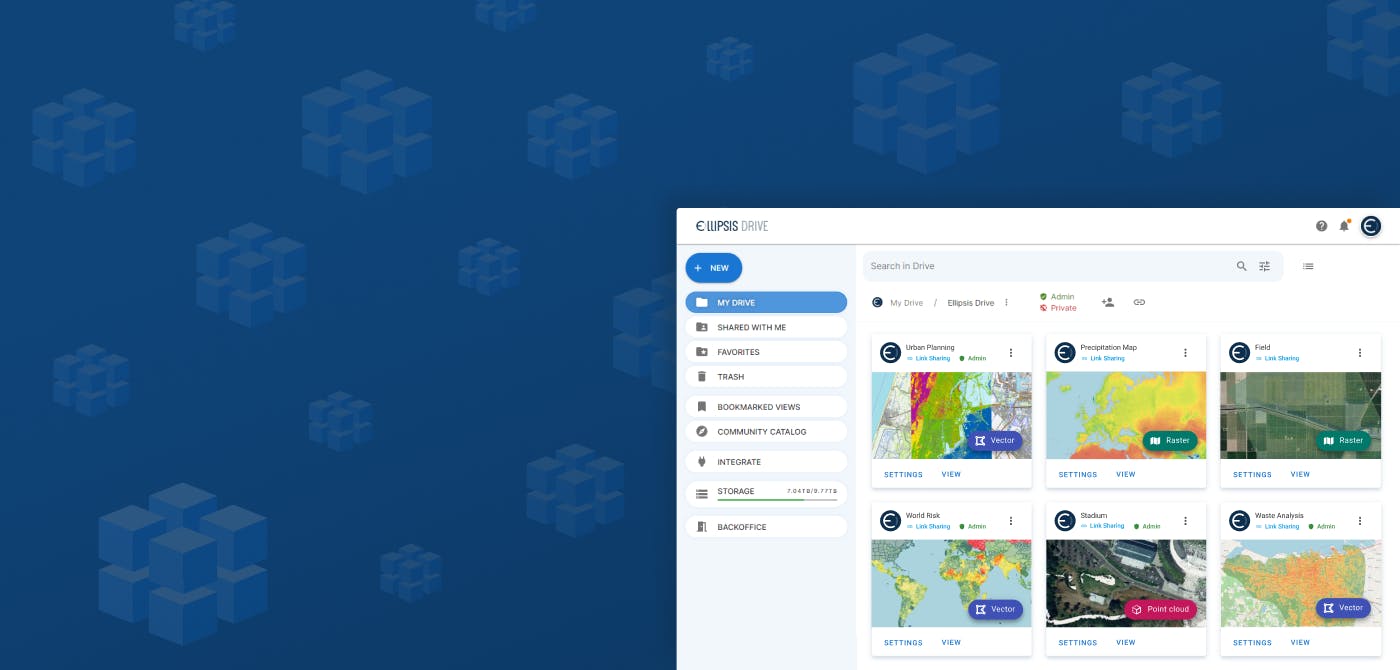
Ellipsis Drive (ED) is a fully interoperable, cloud-based, spatial data management solution that simplifies and automates spatial data ingestion, management and integration. It breaks down geospatial data silos by ensuring access to spatial content from every workflow simultaneously.
ED acts as an easy way to manage spatial data without any additional overhead costs. You can host spatial content, choose whom to share it with, and flexibly share your data in the way that fits your needs.
Ellipsis Drive is here for spatial data worth sharing. Would you like to know more about our solution? Book a free demo with our experts and discuss your unique business needs.
Liked what you read?

Subscribe to our monthly newsletter to receive the latest blogs, news and updates.
Take the Ellipsis Drive tour
in less than 2 minutes'
- A step-by-step guide on how to activate your geospatial data
- Become familiar with our user-friendly interface & design
- View your data integration options
