Live Maps, Faster Decisions: Radar Surveillance Reimagined
Contents
Introduction: Importance of Radar Intelligence in an Unpredictable World
Radar remains one of the most resilient sensors in the defense and security landscape. It is capable of operating day or night, in all weather, and across vast distances. Hence, it plays a critical role from air and maritime domain awareness, to border security and early warning systems. The military radar market was valued at about USD 35.6 billion in 2023, and is forecasted to grow to over USD 211 billion by 2032, at a compound annual growth rate of roughly 20-95%.
Despite this exponential growth and increasing reliance, many organizations still wrestle with delayed analytics, manually processed data, and disconnected software tools. The reality: a radar return captured in one moment may be processed hours or even days later. That’s far too slow when decisions need to be made instantaneously.
This gap between data availability and actionability is more than an efficiency problem. It’s a risk. As threat environments become more dynamic, having an “always-on”, high-fidelity, map-native platform is no longer optional; it’s essential.
This article explores how Ellipsis Map Engine transforms radar from a complex, technical dataset into live, map-native intelligence. We’ll look at the limitations of today’s workflows, walk through a practical use case in maritime surface monitoring, and outline the operational and business value of treating radar as a dynamic spatial layer rather than a static technical feed.
Let’s go!
The Status Quo: Radar Workflows Stuck in Slow Motion
Behind every radar return is a long chain of processing steps. Data is first downloaded in raw raster form, then manually corrected for distortions, filtered for noise, and converted into formats that downstream tools can read. Only after this does analysis begin, often in specialized GIS software that most decision-makers cannot easily access.
In practice, this means radar data is passed from one expert team to another, losing time at every hand-off. Reports are ultimately shared as static images or PDFs, disconnected from the dynamic nature of the underlying signals.
The result is a paradox: organizations invest billions into state-of-the-art radar infrastructure, yet the intelligence it produces can take hours or even days to reach the people who need it most. In mission-critical domains like air defense or maritime surveillance, that delay can be the difference between timely action and missed opportunity.
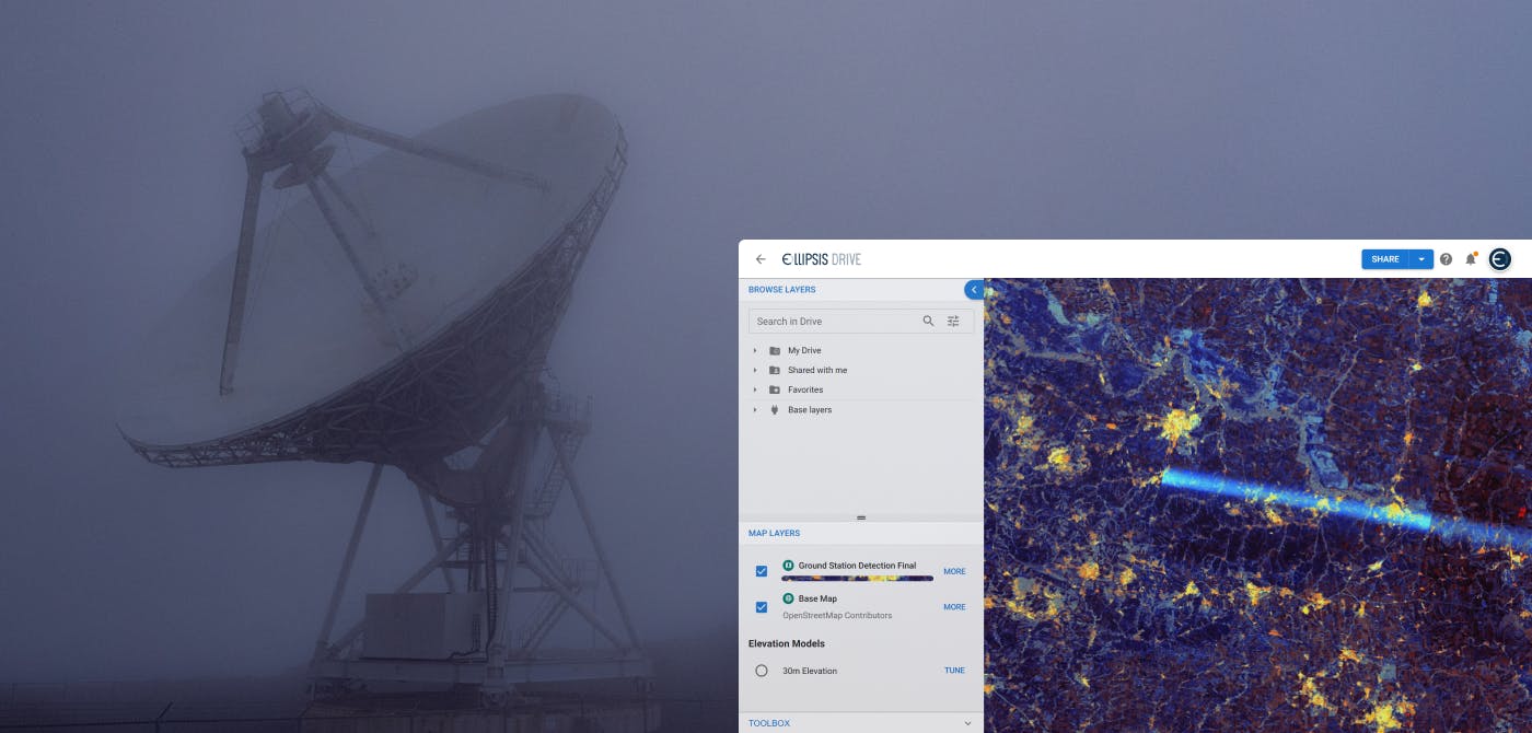
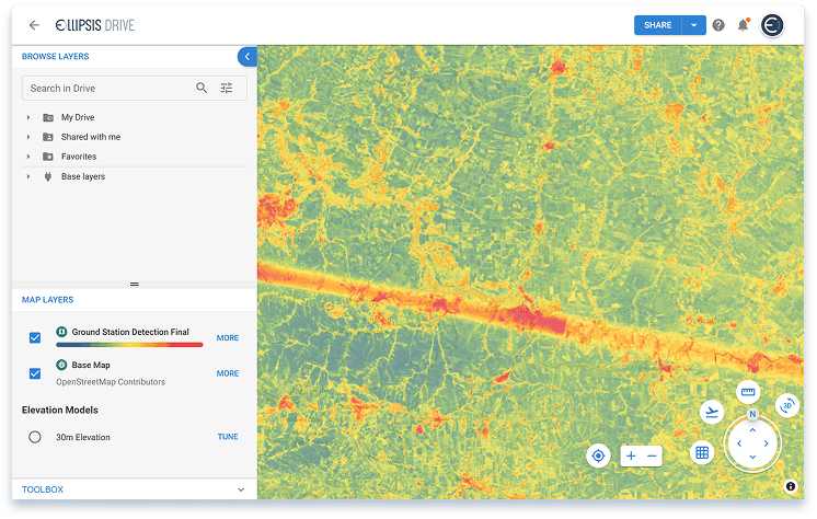
Ellipsis Map Engine: Turning Radar into Live, Actionable Maps
Ellipsis Map Engine was built to remove the friction from working with raster data (i.e. satellite imagery, radar returns, elevation models) by making it map-native from the ground up. Instead of forcing raw radar signals through fragmented pipelines, Map Engine ingests, processes, and serves them as live spatial layers that can be explored, analyzed, and shared in real time.
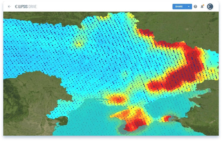
To illustrate, consider a maritime surface monitoring scenario. A coastal defense team wants to track vessels operating near a strategic shipping lane. Traditional workflows might involve downloading SAR imagery, mosaicking large raster tiles, filtering noise, and exporting results into static GIS dashboards. This process could take hours, by which time the picture at sea may already have changed.
With Map Engine, the workflow looks very different:
- Ingest radar feeds directly into the platform, which automatically shards and indexes them spatially.
- Apply processing pipelines (such as clutter reduction or anomaly detection) using Map Engine’s distributed compute, without manual conversion or mosaicing.
- Overlay auxiliary datasets, like AIS ship transponder signals or optical imagery, to confirm anomalies.
- Publish results as live map layers, instantly accessible to both analysts and decision-makers through web interfaces or APIs.
In practice, this means a radar return that once took hours to clean and interpret can now be transformed into an actionable layer in minutes. The result: a live, common operational picture that updates as fast as new radar data arrives.
For those curious about the technical underpinnings, such as how raster-to-raster analytics can be performed at scale, our CTO has shared a walkthrough in a Medium article demonstrating how Map Engine handles these workflows in practice.
Unlocking Business and Operational Value
The faster and more clearly radar data can inform action, the more valuable it is. By treating radar returns as live, map-native layers, Ellipsis Map Engine delivers measurable gains across defense and security operations:
Speed of insight: What once took analysts hours of preprocessing can now be reduced to minutes. This accelerates the loop between data collection, interpretation, and response—vital in high-tempo operational environments.
Scale of monitoring: Map Engine’s distributed compute architecture handles massive radar scenes with ease, enabling continuous surveillance across wide maritime zones, airspaces, or borders without bottlenecks.
Clarity for decision-makers: Outputs are served as intuitive map layers accessible via web interfaces and APIs, ensuring generals, commanders, or agency leaders don’t need GIS training to interpret the situation.
Trust and governance: Every layer retains full provenance, allowing teams to track how raw signals were processed which is essential for auditability, training, and mission review.
The outcome is simple: radar evolves from being a technical feed locked inside expert silos to becoming a shared operational asset that informs strategy and action at every level.
Final Thoughts
Radar will remain a cornerstone of defense and security for decades to come. But in an era where threats move faster than ever, the ability to transform raw radar signals into live intelligence is what sets leaders apart. With Ellipsis Map Engine, organizations can bridge the gap between data and decision, ensuring radar fulfills its promise as a real-time asset for situational awareness and mission success.
Ready to see how Ellipsis Map Engine can transform your radar workflows? Connect with our sales team to explore a demo today.
Liked what you read?

Subscribe to our monthly newsletter to receive the latest blogs, news and updates.
Take the Ellipsis Drive tour
in less than 2 minutes'
- A step-by-step guide on how to activate your geospatial data
- Become familiar with our user-friendly interface & design
- View your data integration options
