GIS
Maps are Numbers, you can do Math on Maps
Contents
Introduction
Maps are not just pretty pictures. Behind every satellite image, contour line, and zoning boundary lies a structured dataset, rich with numbers, relationships, and insights waiting to be tapped. And yet, for most people and organizations, maps remain static, isolated, and technically intimidating.
That’s a massive problem. Because data is only as valuable as people’s ability to use it.
Whether we’re talking about flood risk assessments, transportation planning, or demographic shifts, spatial data holds enormous potential. But the real promise of this data is rarely realized, not because it’s bad data, but because it's locked behind outdated formats and workflows.
It’s time for a change.
From Static Files to Living, Computable Maps
We live in an age where almost everything is a service. We no longer download videos,we stream them. We don’t email files, we share links to live, collaborative documents. But spatial data? It's still stuck in the past. Most maps exist as static files: bulky geotiffs, shapefiles, or obscure formats that require specialized tools and skills to interpret.
Turning maps into live, streamable services isn’t just a convenience, it’s a necessity. When spatial data becomes accessible through web-based platforms, we empower users to integrate, analyze, and act on it in real time. That’s when maps truly come alive.
This shift isn’t radical—it’s inevitable. Just as Google Docs replaced Microsoft Word files in email attachments, web maps are set to replace static GIS files. What’s needed is the infrastructure to support that transition.
Spatial Data Transformation
A few years ago, there was a modest attempt to modernize how spatial data is handled with the introduction of Cloud Optimized GeoTIFFs (COGs). It was a step in the right direction, but still rooted in the old, file-oriented mindset. COGs may be easier to stream, but they’re still just files at the end of the day.
The bigger leap is moving from files to services—spatial data environments that can be queried, rendered, and manipulated live over the web. Environments where maps aren’t just viewed, but computed on.
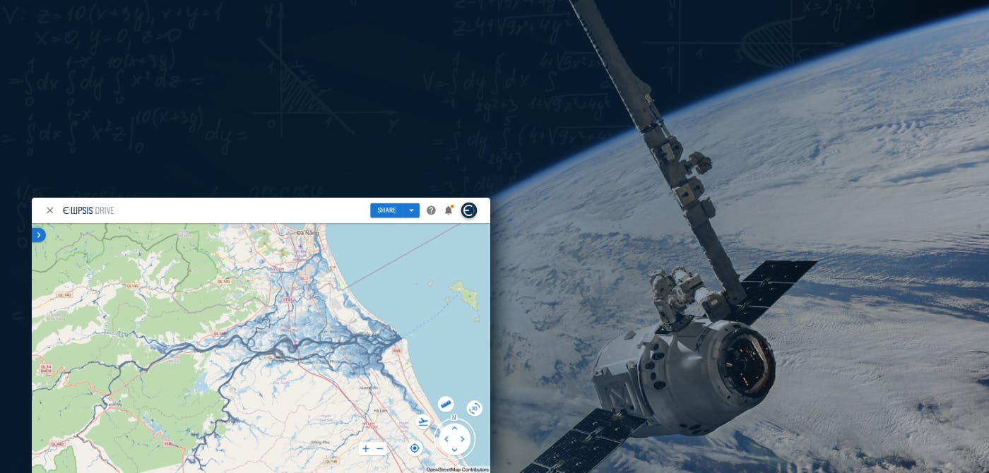
This is where Ellipsis Drive comes in.
At Ellipsis Drive, we believe in breaking down the technical walls that surround spatial data. Our solution is simple at its core: we take your spatial data files—whether from your desktop or from cloud storage volumes—and turn them into interoperable, streamable web services.
Just drag, drop, and go.
The result? Your data is instantly available as a web map. But more than that, it’s made available as a service that can be consumed in any number of workflows. Think of it as the spatial data equivalent of uploading a video to YouTube: once it’s there, it’s easy to share, embed, and build on.
And once maps become services, they become interactive, live, and most importantly,computable.
Applications of Doing Math on Maps
Here’s where things get exciting. When spatial data is live and accessible via APIs, it's no longer locked into a static image. It becomes a dynamic layer of information that you can compute on, just like any other data type.
Want to calculate the average tree cover in a city block? Cross-reference flood zones with demographic data to plan a better emergency response? Integrate land use data into your financial risk models?
All of this becomes possible when maps are numbers, and when those numbers are available in real time.
Spatial data can and should be a first-class citizen in your data stack. But for that to happen, it needs to be treated like the other data types in your stack. It needs to be service-based, interoperable, and easy to plug in.
The true power of spatial data emerges when it’s combined with non-spatial datasets. This is the norm, not the exception. A retail analyst might need to overlay foot traffic data with sales performance. A public health team might combine pollution maps with hospital visit rates.
That’s why Ellipsis Drive is built not just to host your data, but to integrate it into real workflows.
Beyond its intuitive UI, Ellipsis Drive offers a growing suite of integration modules—bridges to popular platforms like Databricks, PowerBI, QGIS, Python, and more. This means your map doesn’t just sit in a silo. It becomes an active participant in your daily operations.
No more custom GIS hacks. No more endless exporting and reformatting. Just clean, live data that works where you work.
Not One Platform to Rule Them All, A Foundation to Build On
It’s tempting to think that a single platform can do everything. But in reality, the best tools are those that play well with others.
Ellipsis Drive isn’t trying to replace your analytics tools or your GIS software. Instead, we are the underlying infrastructure that brings spatial data into those tools seamlessly. We’re a spatial data storage and management layer that’s built for interoperability, collaboration, and—yes—computation.
Because at the end of the day, we don’t just want maps to be viewed. We want maps to be used, queried, and built upon. We want them to be part of your machine learning pipeline, your BI dashboard, your city planning toolkit.
We want maps to be math.
A Future Where Spatial Data Is as Easy as a Google Doc
Right now, spatial data is where cloud documents were 15 years ago—confined to individual hard drives and passed around via email. But the shift is coming, and it’s coming fast.
In a few years, the idea of downloading a shapefile and emailing it to a colleague will feel as outdated as sending a PowerPoint over a floppy disk.
Just as Google Docs made document collaboration effortless, and YouTube made video streaming universal, Ellipsis Drive makes spatial data live, collaborative, and computationally accessible.
Maps are numbers. And once you treat them that way, you unlock a whole new world of insight. If you’re still sending spatial data as files, it’s time to ask: What could you do if your maps were alive? What would change if you could do math on them—live, in real time, from anywhere?
That’s the vision we’ve built at Ellipsis Drive. And we’d love for you to be part of it.
Liked what you read?

Subscribe to our monthly newsletter to receive the latest blogs, news and updates.
Take the Ellipsis Drive tour
in less than 2 minutes'
- A step-by-step guide on how to activate your geospatial data
- Become familiar with our user-friendly interface & design
- View your data integration options

Related Articles

Navigating the Cloud Spectrum: From Generalist to Specialized, and the Perfect Middle Ground
The modern cloud ecosystem spans a wide spectrum of offerings, from general-purpose infrastructure to highly specialized platforms built for domain-specific tasks. At one end, generalist clouds provi
5 min read

Unlocking the Potential of Data: Comparing Tabular and Non-Tabular Protocols
The world of data is a complex landscape and each year, the complexity of that landscape grows exponentially. A combination of new data capturing technology, data processing technology and demands fo
6 min read

Understanding the importance of GIS in Urban Planning
Cities are robust places filled with life, but before it becomes a cosmopolitan paradise, plenty of ever-evolving complexities are happening behind the scenes to bridge the gaps and create an area spa
3 min read