Earth Observation
Building a Sovereign Earth Observation Infrastructure in Europe

Contents
Introduction
In recent years, Europe’s conversation around data sovereignty has evolved. The point of discussion is not just about where information is hosted, but rather about which jurisdictions govern the entire data chain and infrastructure behind it. From raw data capture to post-processing workflows.
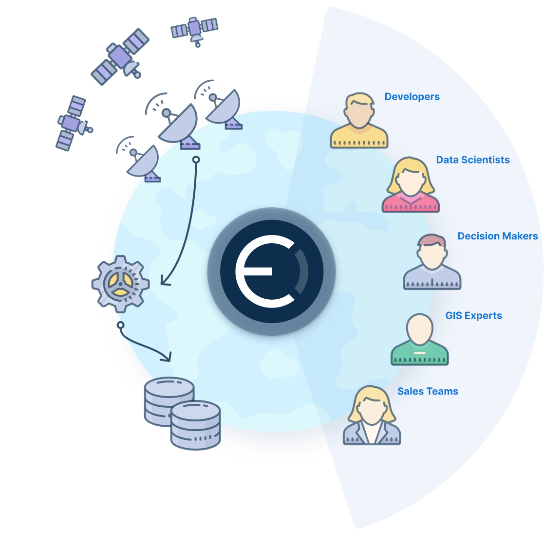
In the Earth Observation (EO) ecosystem, sovereignty is indeed a supply chain question. Who owns the satellites? Who operates the ground stations? Where is the cloud infrastructure located? Who processes the data? And under which jurisdiction does it all happen?
Heightened security requirements, geopolitical sensitivities, and the critical nature of applications like disaster response and infrastructure monitoring have raised the stakes. Stakeholders need assurance that the entire operational chain, from data acquisition to insight delivery, remains within trusted jurisdictional boundaries.
Europe has long had the pieces. Through the European Space Agency (ESA) and the Copernicus programme, it operates a world-class EO constellation. European operators like Airbus provide high-resolution imagery. And companies such as CloudFerro offer sovereign cloud environments on European soil.
But the challenge has been that of end-to-end integration.
ESA’s Endure initiative kicked off to demonstrate that the entire chain, from satellite to actionable insight in the hands of operators, can operate within Europe, powered by European players, under European jurisdiction.
That’s what we shall demonstrate in this blog. Let’s go!
From Space to Insight: Designing the Sovereign Workflow
Sovereignty is a supply chain question. And that supply chain begins in space. Copernicus Sentinel data, overseen by the European Space Agency (ESA), provides frequent and medium-resolution coverage across the globe, while satellites operated by Airbus capture high-resolution imagery on demand.
From space, data is relayed to the ESRIN ground station in Frascati and enters the on-site EO High Performance Compute (EOHPC) private cloud provided by CloudFerro. On EOHPC, CloudFerro operates an end-to-end payload data ground segment platform where the raw imagery can be processed into information and made consumable. To this end, Ellipsis Drive and Ellipsis Map Engine are deployed directly on top of the cloud environment in EOHPC. So as soon as data reaches the cloud infrastructure, it is simultaneously available through Ellipsis Drive making it discoverable, accessible, visualizable, and usable by analytics providers and end users alike.
Downstream analytics companies can pull raw imagery through a unified API, process it, and publish results back into the same environment. Those results can then be accessed via their own endpoints.
Ellipsis Drive acts as a unified service layer between the raw data in EOHPC and analytics providers and downstream users, guaranteeing consumability and ease of use.
Take fire monitoring as an example. Medium-resolution satellite imagery can be continuously scanned to detect thermal anomalies or unusual land-surface changes. When a potential hotspot is identified, higher-resolution imagery is tasked to verify and assess the situation. Analytics providers process the data within the same sovereign cloud environment, generating actionable outputs, such as fire spread projections or risk maps, which are then made directly accessible to civil protection authorities and first responders.
The same logic applies to any other anomaly based monitoring challenge, where changes on the ground are detected, analysed, and translated into operational insights. All without the data leaving the Europe-controlled ecosystem.
Demonstrating that Europe owns all the critical technology pieces is one thing. Ensuring that they all function as a coherent, sovereign infrastructure is another. The Endure project demonstrates both. It proves that Europe can operate an end-to-end sovereign EO chain; and secondly it shows that this chain can deliver actionable intelligence quickly, reliably, and at scale.
Why This Matters: The Strategic Benefits
The Endure project signals something larger about Europe’s strategic direction in Earth Observation.
- A fully European EO supply chain is operationally viable. Satellites, ground infrastructure, cloud hosting, analytics, and service layers can function together without breaking jurisdictional continuity. That matters in a geopolitical environment where infrastructure dependencies are increasingly scrutinized.
- Reduced friction between raw data and actionable insight. By embedding the Ellipsis Drive powered service layer directly into the sovereign cloud environment that runs in the same location as the ground station, data does not need to be fed across any other locations or solutions to become usable. Analytics providers can access imagery through unified interfaces, publish results back into the system, and ensure that emergency responders or other end users receive timely outputs.
- Sovereignty does not have to create silos. In this setup, multiple analytics partners collaborate within a shared infrastructure, while authorized end users retain seamless access to results. Control and openness coexist.
Endure’s core message is therefore strategic, not technical. Europe is capable of orchestrating the entire chain, end-to-end, under its own governance.
Conclusion
Europe’s sovereignty ambitions in space are architectural decisions. Sovereignty is not achieved by isolating systems, but by deliberately designing infrastructure that connects stakeholders across the Earth Observation value chain while keeping European governance intact. The Endure project demonstrates that the entire chain, right from satellite tasking to analytics delivery, can remain within a trusted jurisdiction without sacrificing performance, scalability, or collaboration.
What this case ultimately proves is simple but significant: strategic autonomy is not about building walls around data. It is about building the right foundations beneath it. When infrastructure is designed with sovereignty at its core, and platforms like Ellipsis Drive quietly orchestrate the flow between stakeholders, Europe doesn’t just host its data locally. It owns the workflow, the governance, and the future direction of its spatial intelligence ecosystem.
Liked what you read?

Subscribe to our monthly newsletter to receive the latest blogs, news and updates.
Take the Ellipsis Drive tour
in less than 2 minutes'
- A step-by-step guide on how to activate your geospatial data
- Become familiar with our user-friendly interface & design
- View your data integration options

Related Articles

Infrastructure for a Multi-Cloud Environment
In our previous pieces on data location and sovereignty in Earth Observation (EO) ecosystems, we explored a question that has always existed, but has grown in priority: where is your geospatial data
5 min read
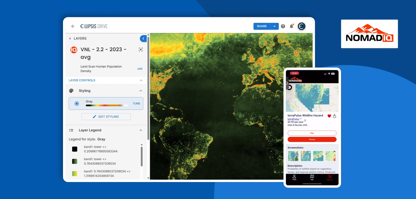
Connecting Earth Observation Datasets to End Users Ft. NomadIQ
“From established basic research and government land management to growing demand in carbon markets, hazard insurance, and even recreational apps, there's a rapidly developing market for satellite-ba
5 min read

A Stable Infrastructure for Radar derived 3D Data Visualization
In the latest episode of The Ellipsis Drive Podcast, our CEO Rosalie van der Maas hosted jC Clark, a professional with over 20 years of experience in Insurance and Earth Observation (EO) entrepreneur
7 min read