Disaster Management
Satellite radar data in flood monitoring
Contents
Introduction
As climate change continues to enforce itself upon the world, natural disasters continue to be on the rise. Floods are one of the most devastating natural events that causes tremendous loss to life and property. The magnitude, frequency and intensity of floods continues to rise with each passing year. Being a force of nature, it might never be possible to negate the risks that it poses completely. But using today’s technology we can definitely be well prepared for it to reduce its impact and subsequent losses.
What are flash floods?
Floods come in all sizes and forms, and hit every possible topography - river banks, coastal areas, mountains and urban areas with poor drainage systems. There are 2 broad components to a flood. First is the weather condition or amount of rainfall and second is the moisture retention capacity of the soil/ground.
Flash floods occur when within a matter of hours (3 to 6 hours) a particular area is completely flooded. This occurs when both the above conditions occur simultaneously. The incident is characterized by torrential rain along with the fact that the underlying surface is unable to absorb the water.
Given the nature and time sensitivity of flash floods, the damage caused is catastrophic and often irreversible.
In recent times, there has been the emergence of highly effective flash flood emergency response teams that are doing a fantastic job to predict such natural disasters and reduce damage. These teams have a flood emergency response plans in place which is backed by satellite radar technology. Even a slight advantage during a flood emergency often proves the difference between life and death.
How does Satellite Radar Technology work?
Satellite radar technology has turned out to be a crucial ally in recent times to reduce the impact of floods on human civilization. It has been of great value especially in developing countries with poor surveillance systems that are highly prone to floods due to lack of appropriate infrastructure. Scalability and reach is definitely one of the strengths of satellite systems.
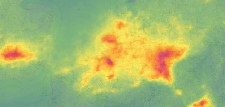
Satellite imagery is used in creating predictive models to identify weather patterns and approximate the amount of rainfall an area is likely to receive.
Spatial images of the ground can help detect the water retention capacity of the ground. Once the soil has reached its maximum water retention capacity, water starts rising above the ground level and causes flooding.
By combining the 2 pieces of the puzzle together, data scientists can accurately foresee floods before they are hit and can save countless lives, livestocks and infrastructure.
Benefits of Satellite Radar Technology?
Prevention is better than cure, but when it comes to mother nature, we have to take what we get. The sheer unpredictable nature of it all makes decision-making that much more difficult in the case of flood monitoring. There are 2 components to the way in which satellite radar technology is leveraged -
1. Preventive Measures
By running predictive models data scientists can predict which parts are likely to be the worst hit. Evacuation plans can be made to reduce the impact especially near the downstream parts of rivers, low lying coastal cities and areas around a dam.
A risk assessment and prioritization table can be created based on the threat levels and economical losses can be provisioned for.
In the long run, drainage systems can be created to ensure areas most prone to flooding are looked after and the inevitable is delayed for as long as possible.
2. Damage Assessment
Because of its remote nature, satellite imagery is extremely useful for first responders and disaster relief programs in the aftermath of a natural calamity. The most severely hit areas of a flood are oftentimes inaccessible and it is extremely difficult to allocate resources and support on time without aerial imagery. It provides ground realities when it matters the most.
By doing a before and after snapshot analysis we can assess the severity of the flooded areas and allocate resources accordingly, a concept often known as change monitoring or change analysis.
Conclusion
While there are many ‘cool’ use cases of satellite data and remote sensing, saving lives will always be of utmost importance. Efficiently tackling floods is one of the most important use cases of satellite data and it is only going to get fine tuned and optimized from here on out.
One of the key elements of a successful execution plan of this nature is quick turnaround time. Dealing with spatial files has always been a cumbersome task with the need to pull out data via API calls and lack of simultaneous access being some of the many issues.
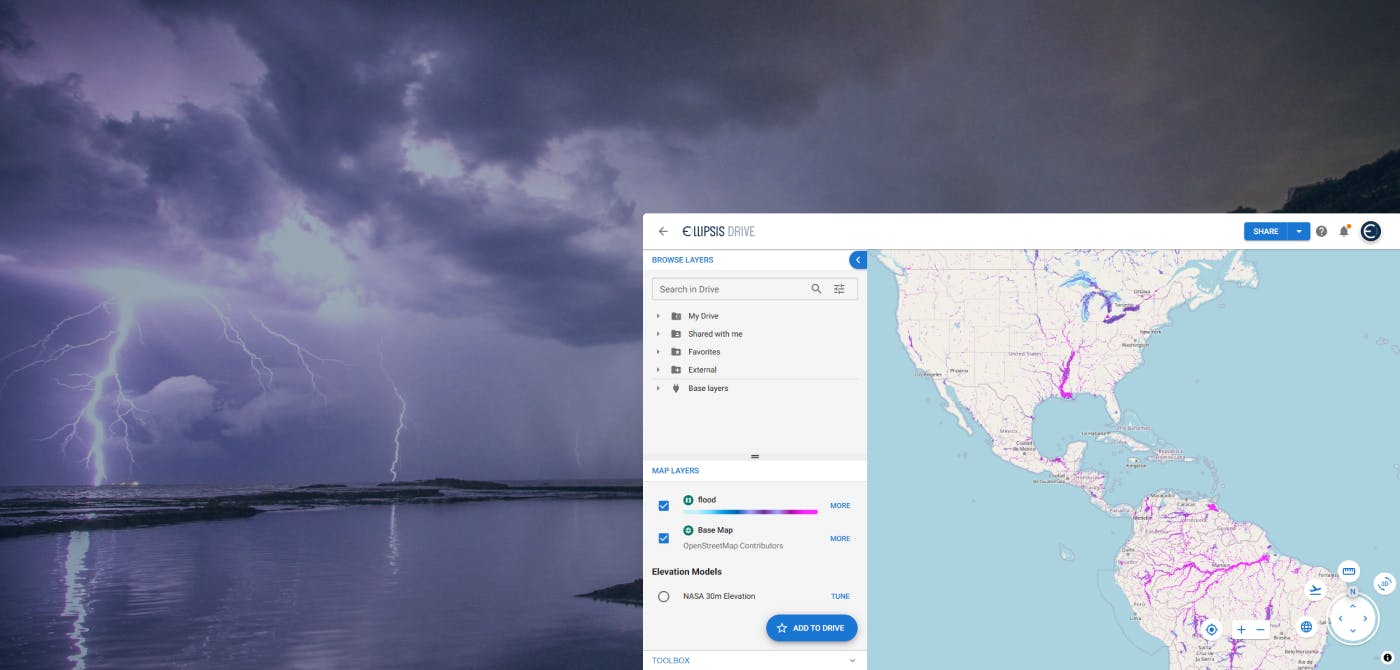
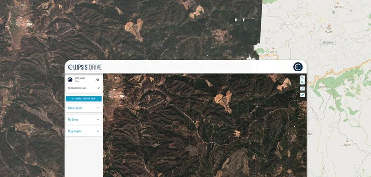
Ellipsis Drive’s simple plug and play collaborative solution could play a key role in use cases such as these where timing is everything. Our solution converts raw spatial files into a single, live and interactive map. With multiple endpoints our solution provides simultaneous. Editing and versioning makes project management hassle free and seamless.
Get in touch with us today and find out how your organization can benefit from our organization!
Liked what you read?

Subscribe to our monthly newsletter to receive the latest blogs, news and updates.
Take the Ellipsis Drive tour
in less than 2 minutes'
- A step-by-step guide on how to activate your geospatial data
- Become familiar with our user-friendly interface & design
- View your data integration options

Related Articles
Flood Risk Management with Ellipsis Map Engine
Flooding is the most common and costliest natural disaster worldwide. In 2023 alone, global insured losses from natural catastrophes topped $123 billion, with floods accounting for a growing share of
5 min read
Near Real-Time Natural Catastrophe Assessment
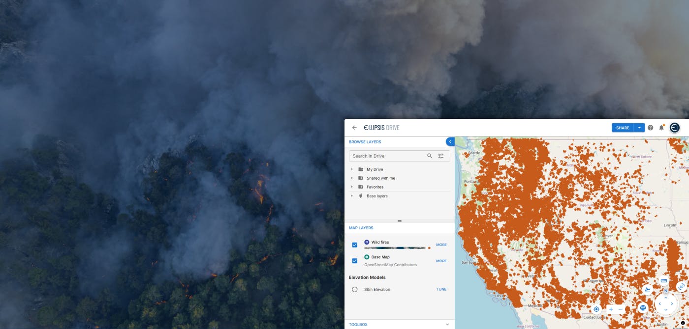
Natural catastrophes such as earthquakes, floods, and forest fires are becoming more frequent and less predictable, largely due to the accelerating effects of climate change. This escalating volatili
6 min read
Satellite Radar Data to Monitor Land Subsidence
The Earth continues to go through drastic changes in the 21st century. As the human population rises and the exploitation of natural resources rises along with it, the Earth continues to retaliate in
3 min read