GIS
The Importance of a Spatial Data Management Solution in Agriculture
Contents
Introduction
The agriculture and crop sector faces numerous challenges in maximizing productivity, minimizing resource waste, and ensuring sustainable practices. Spatial data, tied to specific geographic locations, provides valuable information about the physical characteristics, conditions, and distribution of agricultural land, crops, and resources. It enables precise decision-making and optimization of agricultural practices.
In this article, we will highlight the role of spatial data in agricultural decision-making processes, the key features of spatial data management solutions, and their impact on operational efficiency, decision-making, resource optimization, and environmental sustainability. We will also discuss relevant use cases, challenges, best practices for implementation, and considerations for successful adoption.
First off, let’s explore the importance of spatial data management solutions in the agricultural sector.
5 Reasons why a Spatial Data Management Solution is crucial for the Agricultural Sector
1. Data Integration and Interoperability: Agriculture involves multiple stakeholders, including farmers, researchers, government agencies, and agronomists, each generating and utilizing diverse datasets. An interoperable spatial data management solution allows for seamless integration of different data sources and formats. It enables the harmonization and synchronization of spatial data from various systems, enabling stakeholders to access and share information easily. This promotes collaboration, enables comprehensive analysis, and supports holistic decision-making processes.
2. Efficient Data Automation: Agriculture generates vast amounts of data from various sources such as sensors, satellites, drones, and machinery. A spatial data management solution that emphasizes data automation streamlines the process of data collection, processing, and analysis. Automated workflows and algorithms can be implemented to collect and update spatial data in real-time, reducing manual effort and improving data accuracy. This enables timely decision-making and enhances the overall operational efficiency of the agricultural processes.
3. Seamless Data Ingestion: Agricultural operations involve continuous data ingestion from diverse sources. A spatial data management solution that prioritizes efficient data ingestion allows for the smooth and timely capture of data from different sensors, IoT devices, and other sources. This ensures that the most up-to-date spatial data is available for analysis and decision-making. Real-time data ingestion also facilitates quick detection of anomalies, early identification of issues, and prompt response to potential challenges, such as pest outbreaks or water stress.
4. Scalability and Flexibility: The crop and agriculture sector encompass vast areas of land and involve numerous stakeholders. A spatial data management solution that focuses on interoperability, data automation, and ingestion should be scalable and flexible to accommodate the needs of various users and adapt to evolving technologies. It should support the integration of new data sources, emerging technologies, and evolving standards seamlessly. This scalability and flexibility enable the system to grow with the needs of the sector and ensure its long-term viability.
5. Enhanced Decision-Making: Timely access to accurate and integrated spatial data enables stakeholders to make informed decisions. A spatial data management solution that emphasizes interoperability, data automation, and ingestion provides a comprehensive view of the agricultural landscape, crop conditions, and resource availability. It facilitates data-driven decision-making processes, such as optimizing irrigation schedules, predicting disease outbreaks, and identifying areas for yield improvement that all contribute to the shift towards precision agriculture. This leads to more efficient resource allocation, reduced risks, increased productivity, and improved overall farm management.
Now that we have outlined the reasons why a geospatial data management solution is uncompromisable for the agricultural sector, let’s explore some use cases that give more meaning to the above points.
Use Cases of Spatial Data Management Solutions in the Agriculture Sector
Crop Health Monitoring: By integrating data from remote sensing, IoT sensors, and weather stations, a spatial data management solution automates the collection and analysis of crop health indicators. Farmers can monitor crop health, detect anomalies, and take timely action to prevent disease outbreaks or nutrient deficiencies.
Precision Irrigation Management: A spatial data management solution combines data from soil moisture sensors, weather forecasts, and crop water requirements to automate irrigation scheduling. It provides recommendations for optimal irrigation timing and amounts, leading to efficient water use and improved crop productivity.
Yield Prediction and Harvest Planning: By integrating historical yield data, climate information, soil characteristics, and satellite imagery, a spatial data management solution automates yield prediction and harvest planning. Accurate yield estimates, identification of high or low productivity areas, and optimized harvest schedules contribute to better resource allocation and decision-making.
Pest and Disease Management: A spatial data management solution that integrates data from pest and disease monitoring systems, weather data, and crop growth stages provides early warnings about potential pest or disease outbreaks. Farmers can take preventive or control measures in a timely manner, minimizing crop losses.
Soil Nutrient Management: By integrating soil nutrient analysis data, crop nutrient requirements, and fertilizer application records, a spatial data management solution automates soil nutrient management. It provides recommendations for precise fertilizer application, optimizing nutrient usage and improving crop yield.
No disruptive solution comes without a certain set of challenges that need to be addressed. If there were no challenges, there would be no disruption would it? Below are some of the key challenges that need to be considered while deploying a spatial data management solution onto agricultural projects.
Challenges and Considerations
Data Privacy and Security: Spatial data management solutions must address concerns related to data privacy and security. Appropriate measures should be implemented to protect sensitive data and ensure compliance with regulations.
Technical Infrastructure: Implementing spatial data management solutions requires a robust technical infrastructure capable of handling large volumes of data, ensuring data integrity, and supporting real-time analysis. Adequate infrastructure must be in place to support efficient data collection, processing, and storage.
Data Quality and Standardization: Maintaining data quality and standardization is crucial for effective spatial data management. Data validation, verification, and adherence to industry standards are essential to ensure the accuracy and reliability of spatial data.
Don’t worry, we’re not going to leave you high and dry with a set of challenges without a list of best practices to go along with them. Here are some important implementation considerations for you to take into account.
Best Practices for Implementing Spatial Data Management Solution
Establish Clear Objectives and Requirements: Clearly define the objectives and requirements of the spatial data management solution based on specific agricultural needs. Identify key stakeholders and involve them in the planning and implementation process.
Ensure Data Interoperability: Select a spatial data management solution that supports data interoperability, enabling seamless integration of diverse datasets. Consider open standards and protocols to facilitate data exchange between different systems.
Automate Data Collection and Processing: Implement automated workflows and algorithms to collect, process, and analyze spatial data in real-time. Leverage technologies such as sensors, drones, and satellite imagery for efficient and timely data acquisition.
Prioritize Scalability and Flexibility: Choose a spatial data management solution that can scale and adapt to evolving needs. Consider future growth, emerging technologies, and changing data requirements to ensure the long-term viability of the solution.
Address Data Privacy and Security Concerns: Implement robust security measures to protect spatial data from unauthorized access or breaches. Ensure compliance with data privacy regulations and establish data governance policies to maintain data integrity and confidentiality.
Conclusion
Spatial data and spatial data management solutions play a vital role in optimizing agricultural practices, enhancing decision-making processes, and achieving sustainable outcomes. By focusing on data automation, interoperability, and ingestion, stakeholders in the agriculture and crop sector can harness the full potential of spatial data, leading to improved operational efficiency, resource optimization, and environmental sustainability.
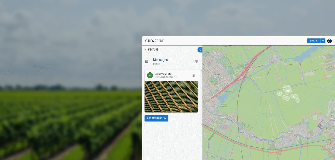
Ellipsis Drive is an advanced spatial data management solution that simplifies and automates spatial data ingestion, management and integration. Our core values revolve around simplicity, scalability, and interoperability. Our user interface is designed to be user-friendly, enabling anyone to work with spatial data. We convert uploaded spatial files into beautiful live maps and web services, organizing them just like your favourite drive for office documents.
Interested in knowing more about us? Check out our unique solution!
Liked what you read?

Subscribe to our monthly newsletter to receive the latest blogs, news and updates.
Take the Ellipsis Drive tour
in less than 2 minutes'
- A step-by-step guide on how to activate your geospatial data
- Become familiar with our user-friendly interface & design
- View your data integration options

Related Articles

Why AI is Reshaping Spatial Data Infrastructure
Artificial Intelligence is rapidly reshaping expectations around geospatial workflows. Organizations no longer want static outputs or slow analytics cycles. They want near real-time insights, scalabl
5 min read

Navigating the Cloud Spectrum: From Generalist to Specialized, and the Perfect Middle Ground
The modern cloud ecosystem spans a wide spectrum of offerings, from general-purpose infrastructure to highly specialized platforms built for domain-specific tasks. At one end, generalist clouds provi
5 min read

Unlocking the Potential of Data: Comparing Tabular and Non-Tabular Protocols
The world of data is a complex landscape and each year, the complexity of that landscape grows exponentially. A combination of new data capturing technology, data processing technology and demands fo
6 min read