Use Case
Aerial imagery in urban/municipal change detection
Contents
Introduction
Humanity is currently at the epitome of its civilization. There are new innovations and advanced technologies popping up every day that have brought us to this point. And of course, there is the internet, connecting us all.
Over the last century, humankind has also attempted to conquer the mighty skies above us. Countless satellites have been launched into space. Having eyes in the sky to monitor our Earth of course has innumerable benefits.
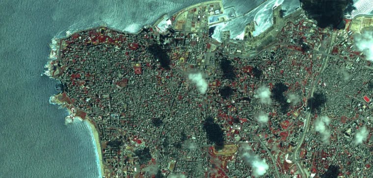
One such use case of these aerial images captured by satellites is in the realm of change detections in urban areas. Clever service providers who leverage this data source to detect relevant changes, are turning out to be very useful resources for municipalities, local governments and tax offices.
Need of Smart Surveillance
Municipal administration has been an age-old problem. The organizations involved in this space have always been prone to inefficiencies, time lags and miscommunication because of the number of moving parts and personnel involved.
Project Management
Nothing backfires upon a new initiative as mismanagement does. For example, deploying solar panels and green rooftops in a city to make it more environmentally friendly is a wonderful idea. But the execution sometimes falls short. In a project like this, there is always a gap between closed room expectations and ground realities.
Aerial imagery provides a solution to this problem. With real time images, project managers can closely and accurately monitor the progress being made on the ground and make necessary intervention whenever necessary. This initiative saves time, money and effort for project managers.
Tracking Changes
A city is always evolving and morphing. Companies and individuals constantly change, improve and expand their properties. These changes need to be approved, logged, and taxed. It is the duty of the city and municipal governments and tax offices, to keep a track of the changes occurring in their city. Easier said than done.
The availability of aerial imagery and competent service providers who can detect and log changes using this data input, allows for hassle free administration. City officials can get a bird's eye view of their territories and inspect any new or illegal extensions or changes made by companies and individuals within city bounds.
Tax bodies can also use these to ensure that taxes are levied accurately and that nothing goes under their radar.
Identifying of New Avenues
It is no secret that population rise has increased the pressure on cities. So it is imperative that land be used efficiently. Local bodies can get a good idea of any changes that have occured in their area in recent times and if any piece of land can be used more efficiently in the future.
Vacant pieces of land can be used to create parks and ensure environmental balance is maintained in cities.
Using Aerial Imagery
Aerial imagery and the technology that goes with it was always these. So what is the difference now you ask? Easy real-time availability of aerial imagery!!
To really leverage spatial data in their operations, organizations need to access them simultaneously and in real time, instead of needing to deal with locally stored raw files that only the technical few can work with… In other words, they need to cut through the complexity of their decentralized administrative setting.
Ellipsis Drive provides a simple and straightforward cloud solution, where raw files turn into live maps in under 10 minutes. The simplicity of the solution is what has made it such an incredible use case. Personnel from varied technical backgrounds can easily access it without too much difficulty. Simultaneous access and versioning with multiple end points means easy access to data and the possibility to track projects real time.
Get in touch with us today and get a live demo from our experts on how our services work and more importantly, how we can help you create efficiencies in your work environment.
Liked what you read?

Subscribe to our monthly newsletter to receive the latest blogs, news and updates.
Take the Ellipsis Drive tour
in less than 2 minutes'
- A step-by-step guide on how to activate your geospatial data
- Become familiar with our user-friendly interface & design
- View your data integration options

Related Articles

The Waterschapshuis: Drought Monitoring in The Netherlands
Despite the small size of the country, The Netherlands is the second largest exporter of agricultural products in the world. What’s their secret? What makes them tick? Well, it is a combination of ide
2 min read

Build Smart, Not Hard: How Element 84 Guides Clients with Spatial Data Infrastructure
For this episode of the Ellipsis Drive podcast, we sat down with Dan Pilone, CEO of Element 84, a geospatial engineering firm known for guiding organizations through some of their toughest technical
5 min read

EarthDefine: Protecting the Earth's Green Cover
Trees are the single most selfless beings on this planet. They have given so much to this world in so many ways. We literally owe them our lives by breathing in the precious oxygen that they produce.
3 min read