Use Case
MBI GeoData: Intelligent Decision Making using Political Risk Data
The 21st century world is a highly globalized one. One that sees a huge and (relatively) free flow of goods, services and people across international borders. While this is an incredible time in human civilization where our joint efforts result in innovation and technology achieving new heights every day, one also needs to be cognizant of the risks that conducting international business operations can imply.
A global world involves countless international entities, dependencies, perspectives and events that need to be accounted for and considered in the decision making process of companies that navigate this international playing field.
In this article, we focus on the work of Michael Bauer International (MBI) Worldwide GeoData. More specifically, we will focus on their new Political Risk Data product - CONIAS Risk Intelligence database.
Contents
MBI GeoData - Intelligent Decision Making using Political Risk Data
MBI Geodata is a German company that creates and aggregates international market and geographic data. As simple as it may sound, their core competence is creating globally consistent and comparable datasets. But don’t forget: Simple isn’t always easy.
Creating such homogeneous datasets allows their users (international and national business entities) to understand the conditions in a comparative context and thus make smarter business decisions. This shifts the approach to decision making from a reactive one, to a proactive one.
Below are some of the data services and solutions provided by MBI GeoData -
- Geocoding (at street level)
- Distance Matrices and Tables
- Raster Mapping
- Data Visualization
In this article we’re going to double click on the Political Risk Data that MBI GeoData creates and one of their data solutions that is derived from this - CONIAS Risk Intelligence: a product line that provides solutions in risk management around various types of political conflicts.
Let’s understand this data set a bit better.
What is Political Risk Data?
As the name suggests, political risk data provides insights into a country or region’s current state of political stability/instability. The situation needs to be understood not only in an absolute sense, but also relative to the past, the (expected) future and in relation to other geographies. That makes it meaningful.
Political risks include war, terrorism, political violence, government restrictions, and civil instability amongst many others.
This is an important consideration for international businesses with expansion plans in order to ensure business continuity, the safety of employees, business assets and future profits.
Political Risk Indices and predictive models are created using several factors that affect the political situation of a country and are used by businesses to make sound, safe and smart decisions.
Visualization of Political Risk Data
As you would’ve figured by just following the news, political risk data is crucial in a system dynamic that can turn volatile.
But despite its importance, the application of this dataset is still in its infancy. This is partly due to the newness and freshness it brings to the table. Many are still unaware of the availability and consumability of data like this, and can have a hard time understanding what it would look like and how to fit it into their processes.
The users of this data type are enterprise decision makers with limited applied technical know-how. Hence, giving them a taste of this dataset via an accessible viewer is very important for MBI’s sales team who need to build trust and traction. Nothing beats the convincing power of good data visualization. Especially for data with a spatial dimension.
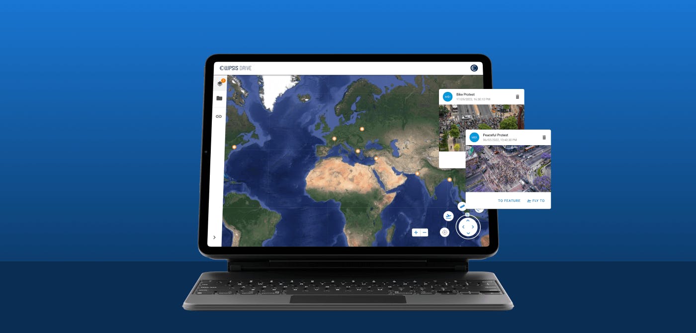
As such, Ellipsis Drive’s viewer is used as a simple visualization tool for MBI’s political risk data. Making it accessible at a low threshold and helping MBI Geodata in bringing this to market.
Ellipsis Drive converts spatial data files into beautiful maps that communicate their value, and the simple interface ensures that business stakeholders with limited technical knowledge can easily explore it and make smarter decisions.
You can check out our solutions page to know more about drive and see for yourself if it fits any of your use cases.
Final Thoughts
In today’s information age, data is power. MBI GeoData aims to empower its users with different types of data solutions. By sharing a common passion for the power of spatial data, our alliance aims to get the most out of these data sets and connect the insights to their intended audience seamlessly.
From data to information, from information to knowledge and from knowledge to success.
Liked what you read?

Subscribe to our monthly newsletter to receive the latest blogs, news and updates.
Take the Ellipsis Drive tour
in less than 2 minutes'
- A step-by-step guide on how to activate your geospatial data
- Become familiar with our user-friendly interface & design
- View your data integration options

Related Articles

The Waterschapshuis: Drought Monitoring in The Netherlands
Despite the small size of the country, The Netherlands is the second largest exporter of agricultural products in the world. What’s their secret? What makes them tick? Well, it is a combination of ide
2 min read

Build Smart, Not Hard: How Element 84 Guides Clients with Spatial Data Infrastructure
For this episode of the Ellipsis Drive podcast, we sat down with Dan Pilone, CEO of Element 84, a geospatial engineering firm known for guiding organizations through some of their toughest technical
5 min read

EarthDefine: Protecting the Earth's Green Cover
Trees are the single most selfless beings on this planet. They have given so much to this world in so many ways. We literally owe them our lives by breathing in the precious oxygen that they produce.
3 min read