Earth Observation
Disaster Management
Near Real-Time Natural Catastrophe Assessment
Contents
Introduction: The Urgent Need
Natural catastrophes such as earthquakes, floods, and forest fires are becoming more frequent and less predictable, largely due to the accelerating effects of climate change. This escalating volatility places immense pressure on emergency response teams, who must act quickly with limited information. Yet, traditional damage assessment methods frequently fail to deliver the timely, accurate data required for an effective response.
Ironically, the technology to drastically improve damage assessment efforts already exists. Dozens of remote sensing satellites orbit Earth, capturing high-resolution imagery of the surface in near real-time. The challenge lies not in data availability, but in efficiently transforming that data into usable insights and delivering it to the right stakeholders—at the right time (in real-time!).
So what prevents this transformation from occurring at the right place in real-time? Let’s explore!
The Obstacles Preventing (Near) Real-Time Catastrophe Assessment
Despite the growing availability of geospatial tools and satellite imagery, real-time spatial data analysis during disasters remains a complex endeavor. Here are some of the key challenges:
1.Data Overload and Fragmentation: During a disaster, data flows in from numerous sources—satellites, drones, local sensors, and field reports. These datasets often come in incompatible formats, varying resolutions, and inconsistent metadata. Integrating this fragmented data into a unified view is a major bottleneck.
2. Latency in Data Processing: Even when imagery is collected in near real-time, processing it into actionable insights can be slow. Traditional GIS systems struggle to keep up with the demand for real-time rendering, analysis, and sharing, especially in low-bandwidth or resource-constrained environments.
3. Limited Accessibility: Many spatial data tools require technical expertise to operate. First responders and local authorities may not have access to trained GIS specialists or high-performance computing systems, delaying critical decision-making.
4. Lack of Standardization: Different organizations use different tools, data formats, and coordinate systems. This lack of interoperability complicates collaboration and makes it harder to build a coherent picture of the situation on the ground.
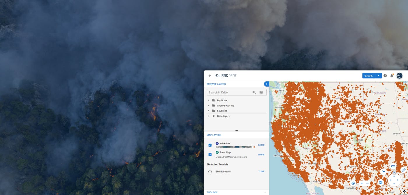
Disaster Management with Ellipsis Drive + Map Engine
In disaster management, timing and clarity can mean the difference between chaos and coordinated relief. Ellipsis Drive and its geospatial processing layer, Map Engine, are purpose-built to overcome the data challenges that often stall emergency response efforts. These tools streamline the way disaster-related data, like satellite imagery, damage assessments, and infrastructure maps, is ingested, analyzed, and shared. By turning complex spatial datasets into actionable insights in near real-time, they empower responders to make faster, smarter decisions when it matters most.
- Real-Time Data Processing: Immediate transformation of spatial files into live maps enables swift decision-making.
- Enhanced Collaboration: Shared access to maps and data layers fosters coordination among various stakeholders.
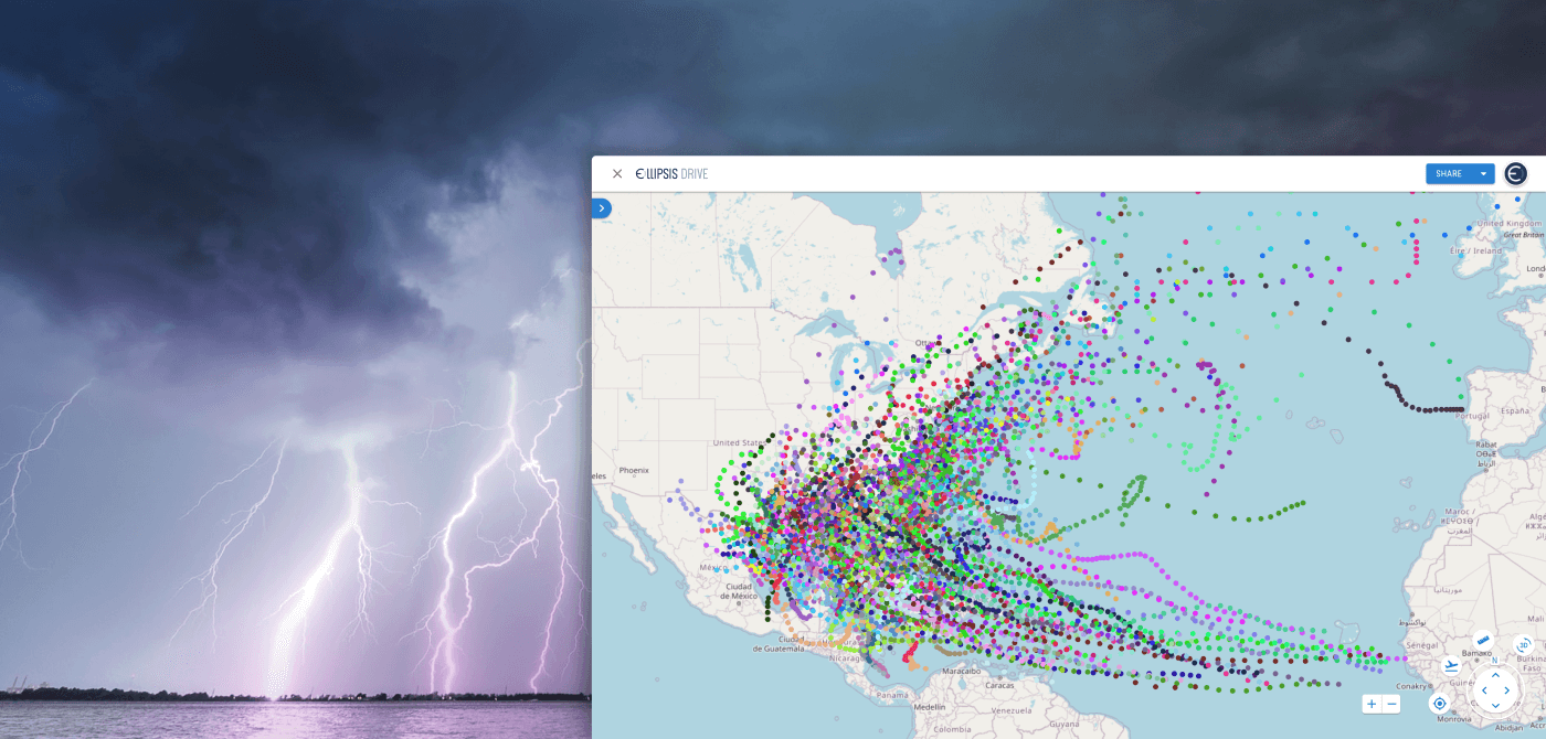
- Scalability: The platform can handle large volumes of data, accommodating the needs of both small-scale and large-scale disasters.
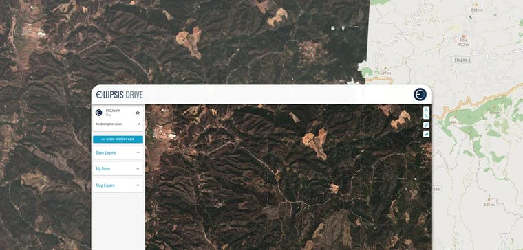
- User-Friendly Interface: Designed to be intuitive, allowing users with varying technical expertise to navigate and utilize effectively.
Use Case: Myanmar Earthquake
On March 28, 2025, a powerful earthquake struck Myanmar, causing significant structural damage in cities like Mandalay. In the critical hours following such a disaster, assessing the scope and scale of destruction is essential for coordinating relief efforts. This case study demonstrates how Ellipsis Drive and Map Engine were leveraged to identify over 200 likely collapsed buildings within hours.
Step 1: Gathering the Right Data
Using openly available datasets from the Humanitarian Data Exchange, we compiled key spatial layers: building footprints, healthcare centers, population density, and change detection derived from Sentinel-1 InSAR imagery. These were uploaded into Ellipsis Drive, which transformed the data into instantly usable, interactive web layers.
Step 2: Detecting Structural Damage with InSAR
The core technique used was InSAR (Interferometric Synthetic Aperture Radar) change detection. By comparing radar images from March 26 and March 29, we identified abrupt surface changes—potential indicators of collapsed structures. These spatial anomalies were visualized as polygons within Ellipsis Drive.
Step 3: Cross-Referencing With Building Footprints
With the change detection layer in place, the next step was to intersect this layer with the building footprint dataset. This was done using Ellipsis Map Engine, which allowed custom Python functions to be run server-side, directly against the hosted data layers. The analysis was distributed across multiple compute nodes, enabling high performance without requiring local machine power.
The Python function performed a geospatial intersection, filtering for buildings that overlapped with areas of detected surface change, marking them as likely damaged or destroyed.
Step 4: Publishing Results for Action
The filtered dataset—over 200 buildings flagged as likely destroyed—was exported back into Ellipsis Drive as a new data layer. This allowed teams on the ground and partner organizations to instantly view the results through a shared web interface, without needing any GIS software.
You can read our more technical article with some of the essential lines of code that were used and a step-by-step tutorial here.
Conclusion: Real-Time Response is No Longer Optional
In the face of escalating natural disasters, speed is everything. The ability to assess damage, coordinate resources, and act in real time can dramatically alter outcomes, saving lives and accelerating recovery. While the data and technology to enable this already exist, the real challenge lies in bridging the gap between raw information and timely insight. This is no longer a nice-to-have; it’s an operational imperative. As we prepare for an increasingly unpredictable future, real-time disaster management must move from aspiration to standard practice.
Liked what you read?

Subscribe to our monthly newsletter to receive the latest blogs, news and updates.
Take the Ellipsis Drive tour
in less than 2 minutes'
- A step-by-step guide on how to activate your geospatial data
- Become familiar with our user-friendly interface & design
- View your data integration options

Related Articles
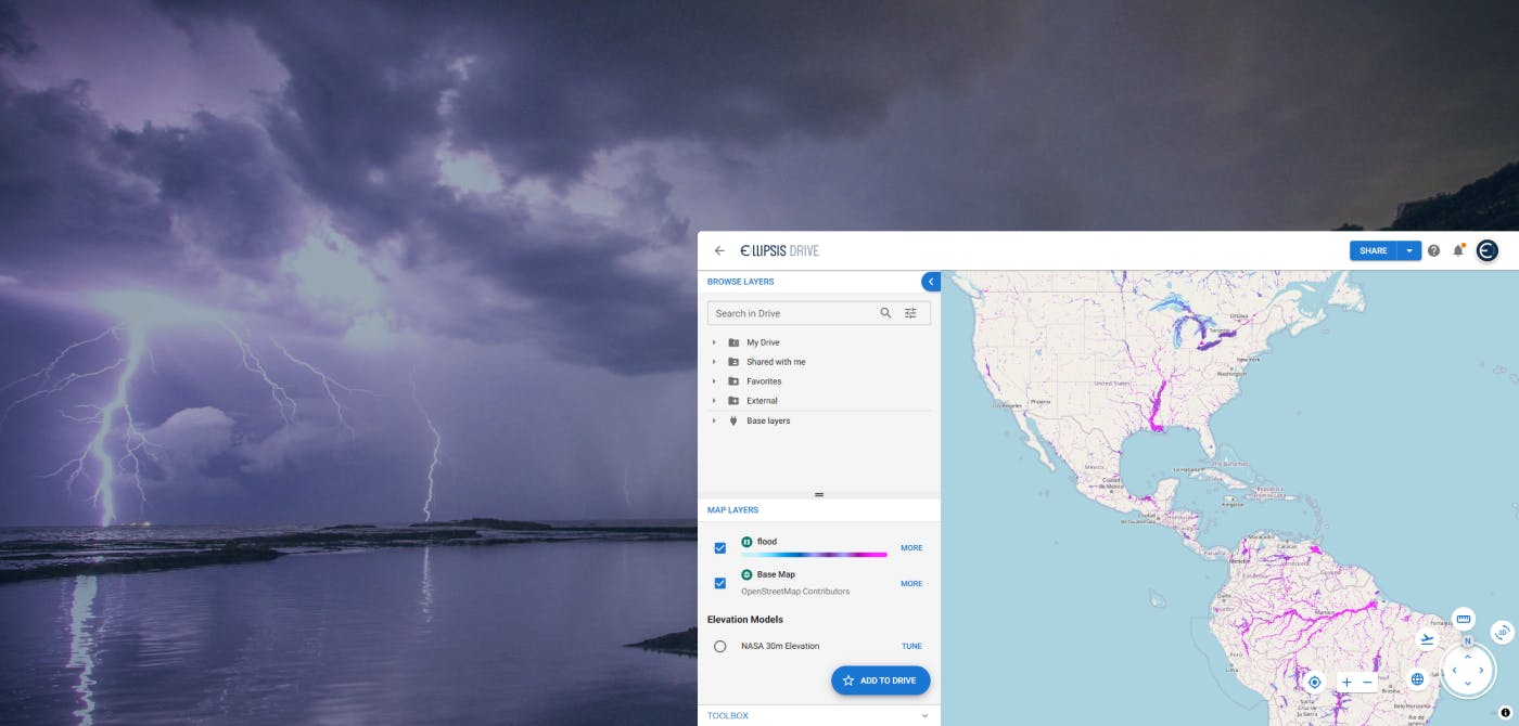
Flood Risk Management with Ellipsis Map Engine
Flooding is the most common and costliest natural disaster worldwide. In 2023 alone, global insured losses from natural catastrophes topped $123 billion, with floods accounting for a growing share of
5 min read
Satellite Radar Data to Monitor Land Subsidence
The Earth continues to go through drastic changes in the 21st century. As the human population rises and the exploitation of natural resources rises along with it, the Earth continues to retaliate in
3 min read
Ellipsis Drive and Catastrophe Modelling
Mastering your spatial data is critical for managing your risk. In this article, we take a deep dive in how spatial data management layers into Catastrophe modelling and how Ellipsis Drive can help yo
5 min read