GIS
GIS and Remote Sensing: A foundation for next generation civil engineering
Geographic information systems (GIS) is essential in a large variety of industries. They provide a convenient and complete platform for creating, storing, analysing, and managing spatial data for a range of applications. This technology is crucial for civil engineering, resource management, geo-analytics, mapping, and research.
The advancements of GIS come into full use when paired with advanced data collection methods, such as remote sensing. This technique allows users to extract various crucial information about terrain, geological features, drainage, hydrology, and many more. Together with GIS, companies and governments can collaborate towards sustainable development.
Contents
How Remote Sensing Improves GIS
The various sources of remote sensing information include aerial photography (using traditional aircraft or unmanned aerial vehicles), satellite imagery, and Light Detection and Ranging (LiDAR). These methods collect data from a distance, allowing GIS professionals to safely analyze it using an easy-to-use spatial data platform.
Remote sensing increases the capabilities of GIS by providing geospatial information even in hazardous areas, such as those experiencing natural calamities. It also provides users with a way to systematically collect data for various applications. Moreover, its unobtrusive processes allow researchers to map areas and objects without disturbance.
Various Applications of GIS and Remote Sensing
GIS and remote sensing both have a number of applications in various fields, forming the foundation of data-driven approaches in engineering, conservation, research, and resource management. Some of the uses of these technologies include:
1 - Analysis and Visualization of Particular Sites
Collecting and processing geospatial data are critical for site analysis and visualization. Professionals can readily access high-resolution images that provide accurate maps of real-world geographic and geological features through GIS and remote sensing. This information can help in tracking changes over time, inspecting qualified construction sites, and studying numerous contexts of a given area.
2 - Sustainable Planning and Development
Urban planning and development need to be as sustainable as possible, reducing the environmental and economic impacts of constructing infrastructures in an area. GIS and remote sensing help generate development models for more accurate monitoring and decision-making. Satellite imaging also helps detect environmental and structural changes in various sites, helping urban planners create safe and sustainable projections.
3 - Infrastructure Safety
GIS and remote sensing provide insights into the safety and security of infrastructures, allowing engineers to identify and detect natural and human-caused threats. The visual information they process can also help professionals view visible changes in infrastructure and mitigate structural risks.
Invest in a Collaborative Mapping Solution
Technological advancements have made remote sensing and geographic information systems work in synergy to provide unobtrusive and systematic processes for many applications. Numerous industries continue to adopt these technologies and expand their capabilities towards safety, sustainability, and data-driven decision-making.
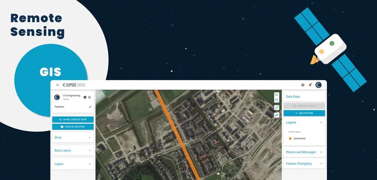
If you’re looking for a collaborative mapping solution that enables you to create, share, and use spatial data, Ellipsis Drive has you covered. We’ll provide you with a spatial data platform that allows you to make the most of your geospatial data. Invest in our solutions—contact us today!
Liked what you read?

Subscribe to our monthly newsletter to receive the latest blogs, news and updates.
Take the Ellipsis Drive tour
in less than 2 minutes'
- A step-by-step guide on how to activate your geospatial data
- Become familiar with our user-friendly interface & design
- View your data integration options

Related Articles

Why AI is Reshaping Spatial Data Infrastructure
Artificial Intelligence is rapidly reshaping expectations around geospatial workflows. Organizations no longer want static outputs or slow analytics cycles. They want near real-time insights, scalabl
5 min read

Navigating the Cloud Spectrum: From Generalist to Specialized, and the Perfect Middle Ground
The modern cloud ecosystem spans a wide spectrum of offerings, from general-purpose infrastructure to highly specialized platforms built for domain-specific tasks. At one end, generalist clouds provi
5 min read

Unlocking the Potential of Data: Comparing Tabular and Non-Tabular Protocols
The world of data is a complex landscape and each year, the complexity of that landscape grows exponentially. A combination of new data capturing technology, data processing technology and demands fo
6 min read