Use Case
Using satellite images the Satellogic way
Contents
Introduction
Doesn't a global scale issue demand a global level approach? We’re talking about pressing matters like climate change, environmental conservation, deforestation, and drought just to name a few.
The magnitude and sheer scale of these calls for a solution, or rather an approach, that takes the entire globe into account. After all, it's all interconnected. Interestingly, the answer to our questions might just be looking down on us right now.
Earth Observation satellites! Satellite images can put the entire globe in one frame. Why not use high quality satellite derived insights to get a bird’s eye view on global challenges?
Satellogic - Democratizing access to critical spatial information
Introducing Satellogic, a company that is committed to making satellite imagery more affordable and accessible, enabling more organizations to innovate and, ultimately, improve life on Earth.
Using high resolution satellite imagery, Satellogic is creating a live catalog of the Earth that will update global coverage weekly, and by 2025, daily. These valuable spatial datasets are in turn used by key stakeholders for decision making in their respective fields.
How do they do it? Satellogic has reinvented the modern satellite by launching microsatellites - a smaller, lighter, and more cost-effective satellite that can be produced at scale. The microsatellites have been installed with state-of-the-art multispectral cameras that make detailed imagery (0.7 meter resolution imagery) a possibility. Each microsatellite is also equipped with a hyperspectral camera and full-motion video capabilities.
Being creators of the components of a satellite itself, their development team was able to put together a device that can not only capture high resolution images but can also be manufactured at a fraction of the cost.
Being a futuristic product with countless use cases, microsatellites have gained interests from organizations all over the world. The satellite imagery is used for decision making, monitoring and prediction modelling and is turning out to be a key component of spatial data science.
How does Ellipsis Drive support the Satellogic mission?
Being such an inquisitive product, potential customers are always wanting a taste of what microsatellites can do. With a new age product, awareness is key. It is crucial for Satellogic’s sales team to be equipped with sample images to show customers that such a powerful product offering does exist.
Click here to get a sneak peek if you want to check it out for yourself! After all, seeing is believing.
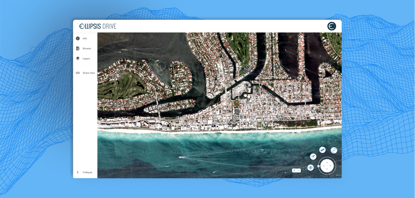
This is where Ellipsis Drive comes into the picture by offering a frictionless sample sharing solution to Satellogic’s sales team. Ellipsis Drive’s first-of-its kind spatial drive is ideally suited for spatial data sharing and showcasing.
By supporting multiple endpoints, simultaneous viewing and using of satellite images is possible. As such, prospective clients can be shown the latest updated images, usable in their own tools of choice! Talk about through the door and into the kitchen.
Creating a searchable Earth
Satellogic is on a mission to create a searchable Earth, and as a result, create a world that makes for a better home for all its inhabitants. Ellipsis Drive is happy to be a part of this mission. Together, everything is possible!
Liked what you read?

Subscribe to our monthly newsletter to receive the latest blogs, news and updates.
Take the Ellipsis Drive tour
in less than 2 minutes'
- A step-by-step guide on how to activate your geospatial data
- Become familiar with our user-friendly interface & design
- View your data integration options

Related Articles

The Waterschapshuis: Drought Monitoring in The Netherlands
Despite the small size of the country, The Netherlands is the second largest exporter of agricultural products in the world. What’s their secret? What makes them tick? Well, it is a combination of ide
2 min read

Build Smart, Not Hard: How Element 84 Guides Clients with Spatial Data Infrastructure
For this episode of the Ellipsis Drive podcast, we sat down with Dan Pilone, CEO of Element 84, a geospatial engineering firm known for guiding organizations through some of their toughest technical
5 min read

EarthDefine: Protecting the Earth's Green Cover
Trees are the single most selfless beings on this planet. They have given so much to this world in so many ways. We literally owe them our lives by breathing in the precious oxygen that they produce.
3 min read