Use Case
Corridor and Asset Monitoring using Earth Observation
Introduction
CAMEO, which stands for "Corridor and Asset Monitoring using Earth Observation", is a collaboration between the S[&]T family, Ellipsis Drive, as well as two Canadian partners. The project is part of the European Space Agency - ESA “Expand Demand” initiatives.
During this project, the participants are going to address short-term and long-term risks and threats to pipeline and electricity cable infrastructure, integrating satellite data (Earth Observation derived information) with:
- environmental data,
- situational data,
- maintenance data,
- and relevant datasets from local and regional authorities.
In other words: it’s a very exciting application that calls on the skills of all the participants. The project involves a large part of the Science [&] Technology family: it is led by S[&]T Norway, and S[&]T NL; Orbital Eye and Sensar contribute too, as well as BGC and Hatfield from Canada. This particular consortium already presented some fascinating scheduling twists: either the Canadians have to get up really early for meetings, or the Europeans have to stay up very late. But the teams have found a compromise: meetings around 17:00 European time are equally annoying for everyone!
CAMEO: Mission and Purpose
Seriously, though: CAMEO aims to help companies and agencies that manage pipeline and energy transmission corridors, better understand and integrate satellite Earth Observation services.
CAMEO’s goal will be achieved by demonstrating the benefits of the Earth Observation-based services in collaboration with asset managers and in-sector providers that do not traditionally use satellite data services.
Showcasing the value of Earth Observation (EO) data happens by executing user-driven demonstration projects where EO-data is combined with traditional on-ground data and cutting-edge data processing and analytics techniques, enabling improved monitoring insights.
These demonstration projects cover a diversity of environments in which the stakeholders operate, with three broad categories of services:
- Structural integrity, e.g. surface deformation, leak occurrence
- Environmental and geo-hazards, e.g. flooding, wildfire, landslides, vegetation change
- Threat assessment, e.g. third-party interference, encroachment
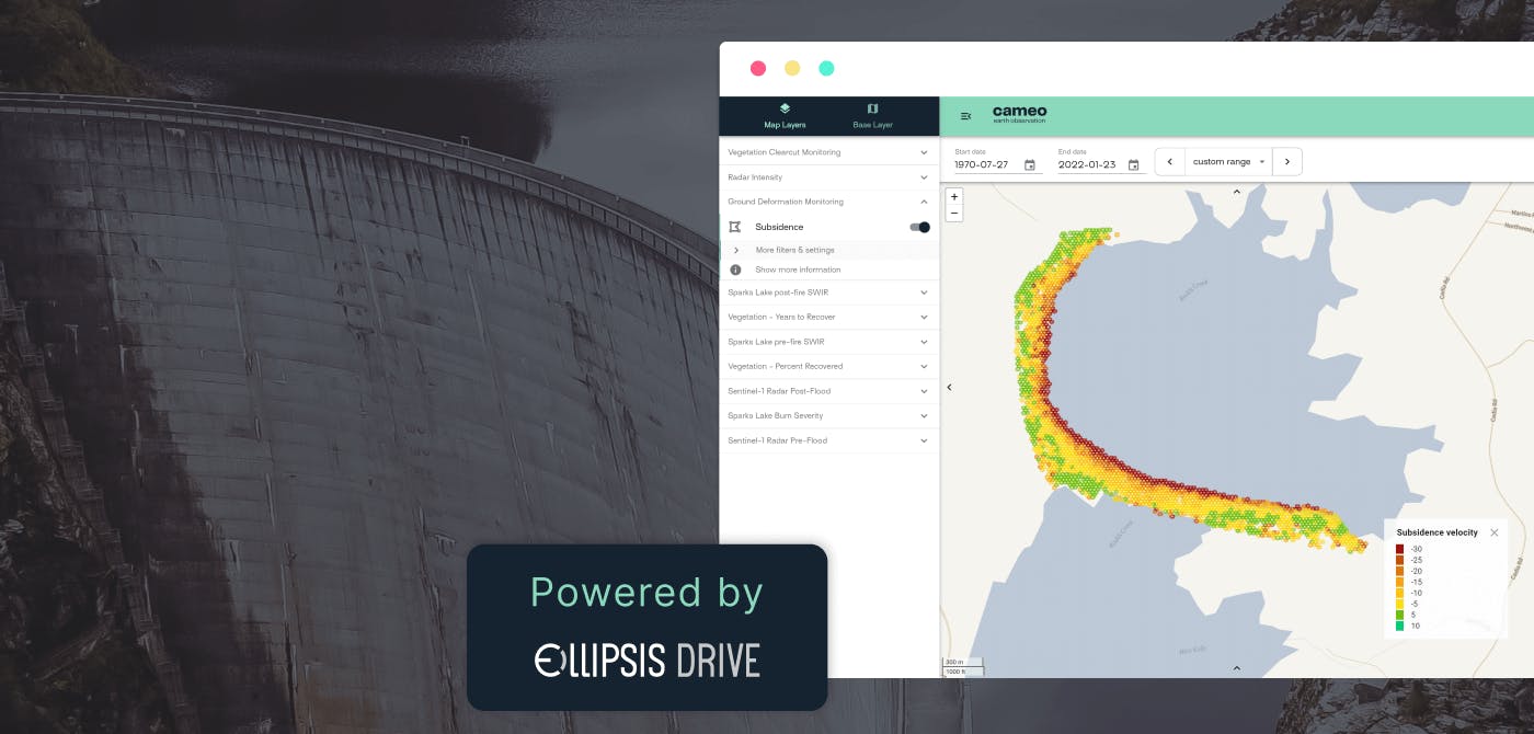
To achieve their goal, the CAMEO consortium has developed a virtual platform, where distributed sources of EO and non-EO data are integrated regardless of which supplier generated the data.
Role of Ellipsis Drive
Successful collaborations in this field starts with good relationships and good data management. So in order to build this platform, the CAMEO consortium uses the technology developed by Ellipsis Drive (conveniently also named ‘Ellipsis Drive’), which allows for easy, simultaneous collaboration on spatial data of any kind and its integration into any workflow or app; in this case the CAMEO virtual platform.
We hope you will stay up to date as the CAMEO project continues to help pipeline and energy transmission companies, better understand and integrate satellite Earth Observation services.
“Our EO based information products place high demands on the flexibility and performance of the underlying data infrastructure. By collaborating with Ellipsis Drive, we can focus on serving the information needs of our customers.”
- Roland Hooghiemstra, CEO of Science [&] Technology Corporation
“We love to support our partners’ goals by bringing in off-the-shelf functionality when it comes to hosting, organizing and integrating spatial data for any type of professional.’’
- Rosalie van der Maas, Co-Founder & CEO of Ellipsis Drive
Conclusion
Leveraging Earth Observation data for the benefit and betterment of life on Earth is an incredible goal to chase. The combined efforts of all the stakeholders involved is creating synergies and end results like never before. Ellipsis Drive is excited to be part of and contribute to such an initiative. A bright and optimistic future awaits us!
The CAMEO platform is available via https://www.cameo-platform.com/.
Liked what you read?

Subscribe to our monthly newsletter to receive the latest blogs, news and updates.
Take the Ellipsis Drive tour
in less than 2 minutes'
- A step-by-step guide on how to activate your geospatial data
- Become familiar with our user-friendly interface & design
- View your data integration options

Related Articles

The Waterschapshuis: Drought Monitoring in The Netherlands
Despite the small size of the country, The Netherlands is the second largest exporter of agricultural products in the world. What’s their secret? What makes them tick? Well, it is a combination of ide
2 min read

Build Smart, Not Hard: How Element 84 Guides Clients with Spatial Data Infrastructure
For this episode of the Ellipsis Drive podcast, we sat down with Dan Pilone, CEO of Element 84, a geospatial engineering firm known for guiding organizations through some of their toughest technical
5 min read

EarthDefine: Protecting the Earth's Green Cover
Trees are the single most selfless beings on this planet. They have given so much to this world in so many ways. We literally owe them our lives by breathing in the precious oxygen that they produce.
3 min read