Use Case
Het Waterschapshuis: Using Digital Elevation Models (DEM) for Water Management
How often do you hear about a natural calamity occurring somewhere in the world these days? Way too often! As we keep testing the limits of our environment, a pushback from nature’s end is an inevitability.
With water levels constantly rising, the threat of flooding has become imminent. The problem is even more prominent in a country like The Netherlands that has a huge part of its land area sitting below sea level, making an effective flood management strategy and emergency response team crucial.
The country is up for it though. Under the close watch and care of its water authorities the ever changing situation is monitored and managed accordingly. In recent years, the creation of a Digital Elevation Model (or ‘Algemeen Hoogtebestand Nederland’ (AHN) for those who speak Dutch) has been commissioned to track nationwide elevation changes in detail.
But what is a Digital Elevation Model? A Digital Elevation Model or DEM is a pictorial elevational representation of the bare surface of the Earth, without buildings, trees or any surface objects. The Dutch ‘AHN’ however, actually does include these details on everything that covers the earth's surface (and this on a whooping 0,5 square meters in resolution). But why do these details on elevation and surface objects matter so much? And how does it relate to water management specifically? Hang tight! We are getting there!
Contents
Het Waterschapshuis - Mission and Approach
Het Waterschapshuis (hWh) carries out the AHN initiative. This Digital Elevation Model (the only one with surface objects included!) provides detailed and precise height data with an average of eight height measurements per square meter.
The hWh makes the DEM publicly available. The water boards, provinces, infrastructure authorities and specialized firms across the Netherlands use this information for e.g. water management and flood mitigation.
Below are some mission critical examples of how this unique data gets leveraged:
- Creating prediction models to gauge the way water flows over land (key information when living in a river delta!)
- Determining water levels in canals and rivers
- Understanding drainage rates
- Test structural readiness (digitally!)
While the above are the strategic and bigger use cases of the DEM created, there are several other day-to-day applications as well. These include the management and maintenance of dikes, making specifications for infrastructure maintenance, 3D mapping, licensing and enforcement.
A detailed version of the AHN is used by local municipalities and companies to identify minor height differences in our built environment to spot a new garden shed, garage or dormer. Information like this is important to create ‘tax maps’ (read more here!).
Implementing the Digital Elevation Model and the role of Ellipsis Drive
AHN data are open source and can be used by stakeholders like those mentioned above for decision making at various stages of water management. For this purpose, easy access to these data is key. After all, open data is not the same as usable data. How it is disclosed to stakeholder and service provider makes all the difference.
To address this consideration of accessibility, the hWh has made all raster files of the AHN (DEM + surface objects) available via PDOK (an open portal for GIS data) since 2016, to ensure consumption of the data is possible in an organization’s own GIS system without needing to download the full data set (which is quite sizable).
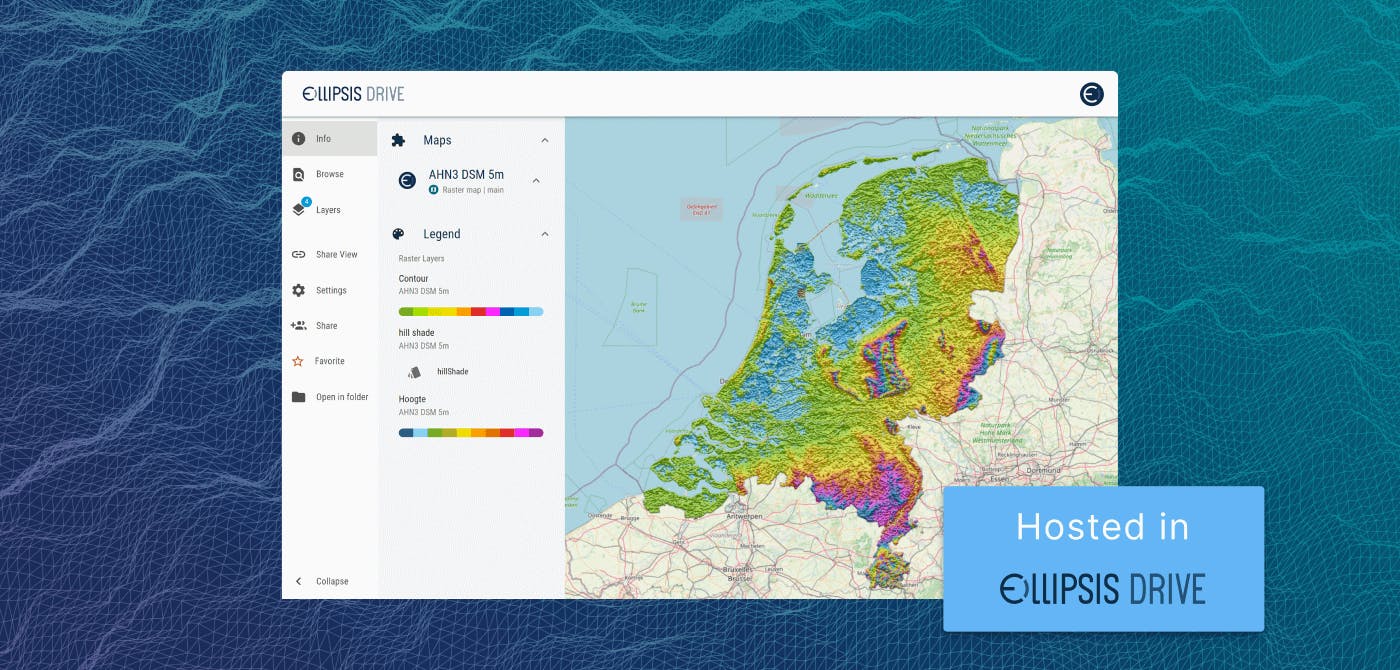
While this was the right first step, there was also major room for improvement in terms of both cost effectiveness and optimal usability for a broad audience. As such, all AHN data (from 2016 to the present day) was moved to Ellipsis Drive. And we are so very proud to be hosting it!
As an organization, we strive to be the most value added hosting platform for spatial data that needs to be used. And the AHN falls squarely within that category!
Our first-of-its-kind spatial drive ensures that the Dutch DEM data is simultaneously available to all stakeholders and service providers via the endpoints, packages and protocols of their choice. Ensuring easy use and high performance when relying on this beautiful dataset.
The plug and play nature of our solution makes Ellipsis Drive the go-to choice when looking to get spatial data available for the right audience. Whatever you need to provide proper access and interoperability, we pride ourselves in having already thought of it! That way, you are just one upload away from your objective.
Conclusion
With global warming picking up pace, proper water and resource management is of ever growing relevance. In this light, good data is our best friend. Especially when it is openly available and easily accessible. Ellipsis Drive understands the importance of this and is very happy to play its part!
Liked what you read?

Subscribe to our monthly newsletter to receive the latest blogs, news and updates.
Take the Ellipsis Drive tour
in less than 2 minutes'
- A step-by-step guide on how to activate your geospatial data
- Become familiar with our user-friendly interface & design
- View your data integration options

Related Articles

The Waterschapshuis: Drought Monitoring in The Netherlands
Despite the small size of the country, The Netherlands is the second largest exporter of agricultural products in the world. What’s their secret? What makes them tick? Well, it is a combination of ide
2 min read

Build Smart, Not Hard: How Element 84 Guides Clients with Spatial Data Infrastructure
For this episode of the Ellipsis Drive podcast, we sat down with Dan Pilone, CEO of Element 84, a geospatial engineering firm known for guiding organizations through some of their toughest technical
5 min read

EarthDefine: Protecting the Earth's Green Cover
Trees are the single most selfless beings on this planet. They have given so much to this world in so many ways. We literally owe them our lives by breathing in the precious oxygen that they produce.
3 min read